


FREEPORT DIST 01, Armstrong County, Pennsylvania
About
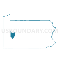
Outline

Summary
| Unique Area Identifier | 657004 |
| Name | FREEPORT DIST 01 |
| County | Armstrong County |
| State | Pennsylvania |
| Area (square miles) | 0.30 |
| Land Area (square miles) | 0.27 |
| Water Area (square miles) | 0.03 |
| % of Land Area | 91.06 |
| % of Water Area | 8.94 |
| Latitude of the Internal Point | 40.67190890 |
| Longtitude of the Internal Point | -79.68990370 |
Maps


Graphs
Select a template below for downloading or customizing gragh for FREEPORT DIST 01, Armstrong County, Pennsylvania


Neighbors
Neighoring Voting District (by Name) Neighboring Voting District on the Map
- ALLEGHENY TWP VTD 02, Westmoreland County, PA
- BUFFALO TWP PCT 03, Butler County, PA
- FREEPORT DIST 02, Armstrong County, PA
- HARRISON TWP WD 03 DIST 01, Allegheny County, PA
- SOUTH BUFFALO TWP VTD EASTERN, Armstrong County, PA
Top 10 Neighboring County Subdivision (by Population) Neighboring County Subdivision on the Map
- Harrison township, Allegheny County, PA (10,461)
- Allegheny township, Westmoreland County, PA (8,164)
- Buffalo township, Butler County, PA (7,307)
- South Buffalo township, Armstrong County, PA (2,636)
- Freeport borough, Armstrong County, PA (1,813)
Top 10 Neighboring Place (by Population) Neighboring Place on the Map
Top 10 Neighboring Unified School District (by Population) Neighboring Unified School District on the Map
- Kiski Area School District, PA (28,857)
- Highlands School District, PA (20,627)
- Freeport Area School District, PA (11,756)
Top 10 Neighboring State Legislative District Lower Chamber (by Population) Neighboring State Legislative District Lower Chamber on the Map
- State House District 54, PA (60,370)
- State House District 11, PA (60,130)
- State House District 33, PA (59,492)
- State House District 60, PA (58,162)
Top 10 Neighboring State Legislative District Upper Chamber (by Population) Neighboring State Legislative District Upper Chamber on the Map
- State Senate District 40, PA (256,162)
- State Senate District 41, PA (236,058)
- State Senate District 38, PA (213,989)
Top 10 Neighboring 111th Congressional District (by Population) Neighboring 111th Congressional District on the Map
Top 10 Neighboring Census Tract (by Population) Neighboring Census Tract on the Map
- Census Tract 9127, Butler County, PA (7,307)
- Census Tract 9512, Armstrong County, PA (5,991)
- Census Tract 4011, Allegheny County, PA (4,447)
- Census Tract 8013, Westmoreland County, PA (4,421)
- Census Tract 9519, Armstrong County, PA (1,813)